Tag: Touareg

Chapter 7: From the Niger border to Arlit.

By Kae Lewis

In the desert, as on the wide sea, the voyager is frequently impeded by storms; a furious wind lifts whirling sand over a plain lacking vegetation, filling the mouth and eyes of the voyager; in this event, it is necessary to halt the journey.

Sallus (97 B.C.)

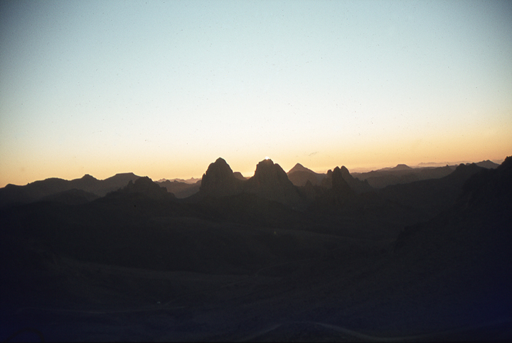
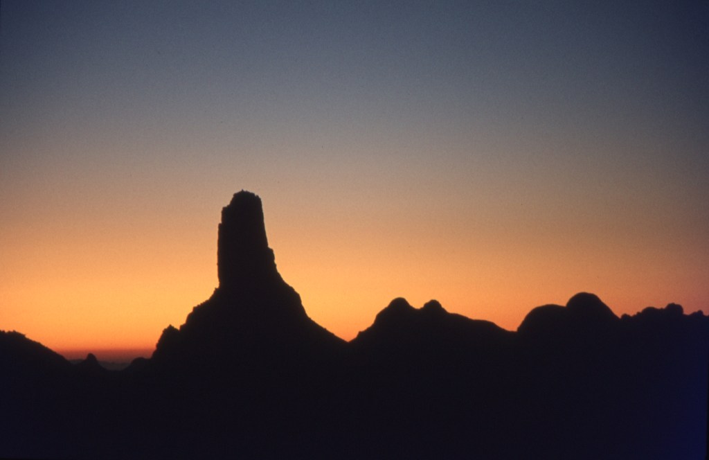
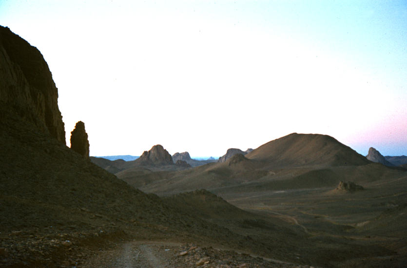
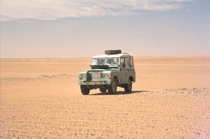
Early the next morning, after we had obtained the required immigration stamp in our passport, we were on our way across no-man’s-land to Assamaka, the Niger border-post.  However, five minutes later we were stuck fast in the sand, still within sight of In Guezzam.  We had failed to choose the correct set of tracks to lead us safely around a hill of sand.  Instead we had gone towards the high ridge in the center, to come to a halt in the deep sand halfway up the steep slope.  Although we dug ourselves out and laid the sand-ladders in front of the wheels, we were unable to pick up enough speed on the hill to launch the van off the sand. We dug out the wheels time and time again before we finally reached a stony patch where the tyres could grip and take the van to the top.  

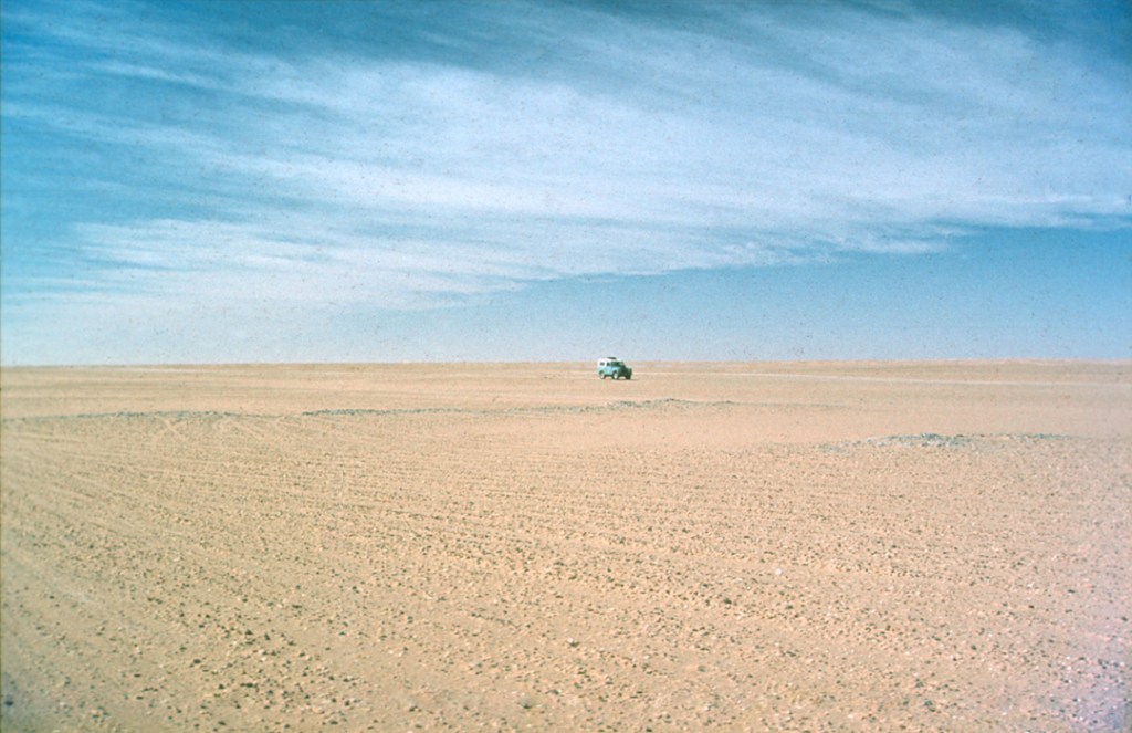
At first, the terrain was rocky with patches of deep sand which had caught in the hollows.  The tyres were still soft for traveling in the sand, and as we bumped and thumped on the sharp rocky ridges, it was remarkable that they were not punctured.  Soon we were traveling on another wide sandy plain where the wind began to fling flurries of sand against the side of the van with an increasingly loud tattoo.  It was not long before our vision became limited to the sand immediately in front of us.

Although we knew it was only 35 km from In Guezzam to Assamaka, we had soon driven about 65 km without seeing any sign of the border-post. We were still following a well-used piste with many vehicle tracks which we could still see clearly despite the blowing sand. However we should have found Assamaka by now, and it seemed we were lost.

The prospect of being lost or broken-down in the Sahara is terrifying, and was something we had done everything we could to avoid, including carrying large numbers of spare parts and excess water. Michael Marriot and his wife, Nita were lost in this same region of the Sahara and ran very short of water. Their main problem was that their elderly London taxi cab kept overheating, and the radiator needed constantly topping up. They carried far less water than we did, and the taxi cab engine used almost all they had. Eventually, they decided to stop and wait for a passing truck to rescue them, rather than risk driving in circles:

The Sahara is trying hard to claim us. We have already broken the strictest rule, and drunk water in the heat of the day; it is a relief for a few moments, then the raging thirst returns, infinitely worse than before. We can no longer smoke, and our lips and eyelids are swollen and painful. It is impossible to talk without great effort. I tell Nita to get under the cab; the heat had caused her to vomit. It has affected me similarly. Now I moisten my wife’s lips with a little water to freshen her mouth. The trickling water is torture to my ears, and the tempatation to drink the remains right away is agony to resist.

Desert Taxi by Michael Marriott. Panther Books, 1956.

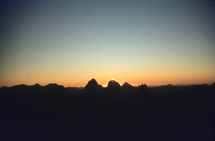
We came upon the five French cars that had left In Guezzam just after us and had overtaken us at speed half an hour before.  They had stopped to talk to a truck driver who was having a picnic in the whirling sand.  He confirmed that we had all missed Assamaka by waving vaguely northwards, the direction from which we had come. Because our distance vision had been blocked by the sand, we had driven straight past it. 

Since the truck driver was giving detailed instructions in French which we could not understand, we decided to try to keep up with the Peugeots. They drove at an incredible pace, and it was almost beyond the capability of the van to stay with them.  We were careering over bumps at such a speed that our large sliding door began to come off.  I hung grimly on to it for as long as I could but eventually we had to stop to repair it and allow the engine to cool.  The Frenchmen immediately stopped too, and it transpired that they knew no more than us about the precise location of Assamaka.  They were relying on us to lead them to it.

The oasis hillock of Assamaka seen in the distance through the swirling sand as we approach it from the south. We had gone straight passed it when we approached it from the north.

During this pause while Evan reattached the sliding door, the wind dropped slightly so that the sand was being whisked up only to knee level, and we could see more clearly into the distance.  As we drove further on, this time with us setting the pace, we saw a distant white mass reflecting the sun and shimmering through the dust and haze.  As we came closer, the square white buildings of the border-post slowly materialized from this mirage. 

Because it lies about one km from the piste that we had been driving on, we left the track to drive straight towards it.  This whole experience illustrates the distinct disadvantage of navigating by using the tracks of others; you have to assume that their destination was the same as your own, and in this case it had obviously not been. During the frequent sandstorms, there must be many travelers searching for Assamaka as we had done.  Assamaka is the only official border-crossing point along the border between Algeria and Niger, although the Touareg and other local travellers cross anywhere they happen to be along the border. There is no-one to stop them.

They put their borderpost in the middle of a trackless desert and expect everyone to find it. Woe betide anyone who enters Niger without first going through this border-post. The other problem of course was that we needed to make a ninety degree turn at Assamaka to reach our intended destination of Arlit and Agadez.

From Assamaka directly south, the nearest town is Tahoua, Niger. This involved 600 miles (1000km) of off-piste travel and was a forbidden zone to tourists without a permit (as was
much of the area which surrounded us). The route south crosses one of the source-areas of the Niger river, and at this time of the year could be subject to flooding. So it was fortunate for us that we decided to turn back and finally found Assamaka.
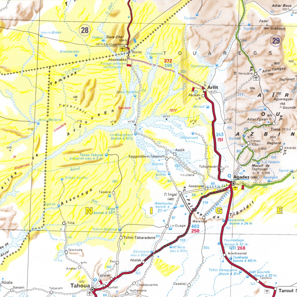
Source: Michelin Map 741 Africa North and West

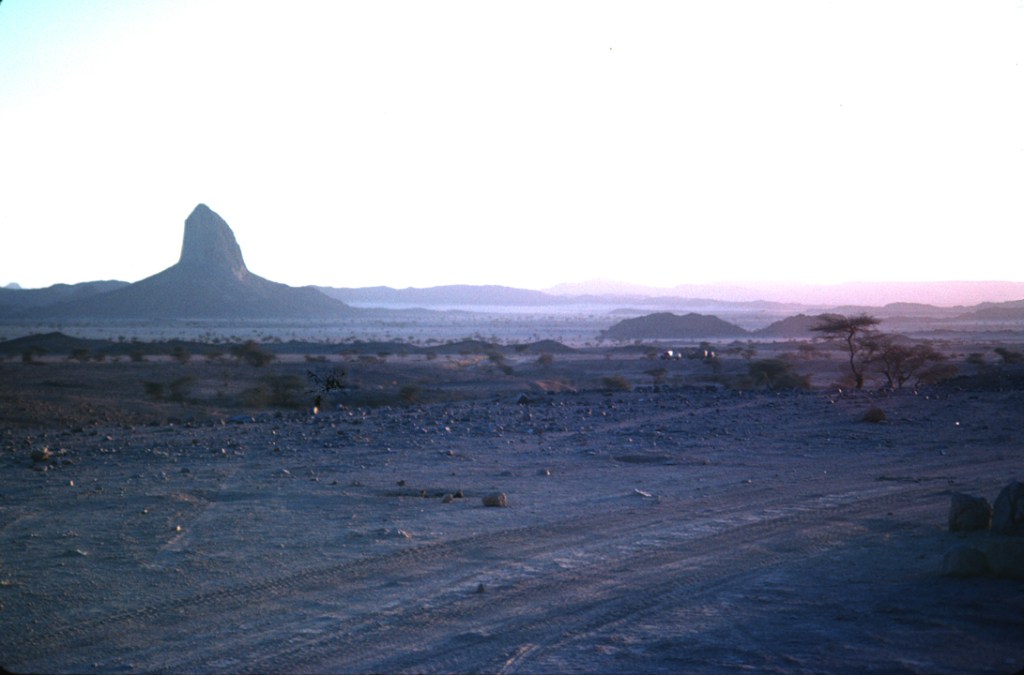
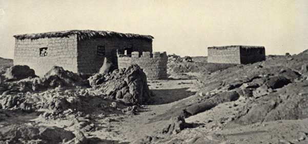
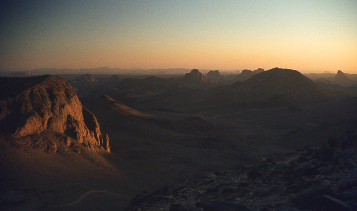
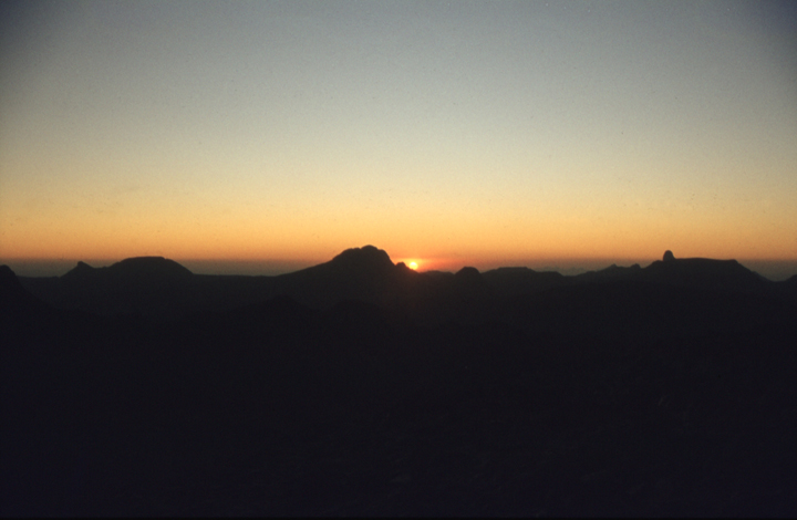
Around the base of the oasis hillock of Assamaka is a large area of deep sand.  It is therefore essential to approach the border-post traveling fairly fast. All six vehicles charged into the compound of the border-post and screeched to a halt amid a great cloud of dust. There was a miniature palmerie beside the small cluster of white-washed buildings which are inhabited only by the border guards with no family dwellings. 

One of the guards collected up all our passports and took them off to the office while customs officers began the treasure hunt. Each vehicle in turn was emptied entirely, with the contents being spread out on the sand. Then the customs officers began to ferret through it all.  We had not rushed forward like our French companions had but stood back to watch the proceedings. However, all too soon, it was our turn.

 “Take-everything-out,” spouted the guard in what proved to be the only sentence of English he knew.  The sand storm was still raging, and our bedding, clothing and food was soon filled with sand. We watched as they diligently flipped through our books, peered into the honey pot and rifled through our underwear.  

 “Velly good,” said the boss-guard when I had finished taking everything from my handbag. Then they passed on to their next victims, leaving us to sort through the mound of our belongings lying on the ground and rapidly being buried in sand by the wind. We now had no clean clothes or bedclothes, and all our food supplies were gritty. And of course there was no water to remedy the situation. 

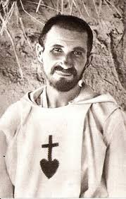
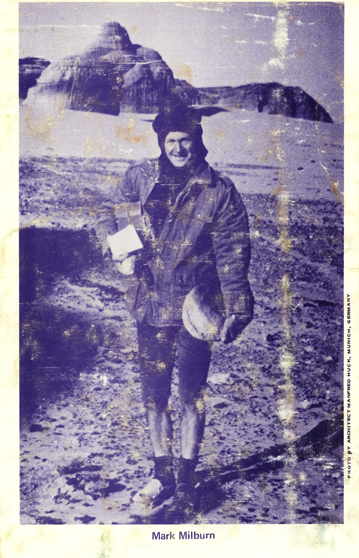
While we waited for our passports to be returned, we noticed an English-registered Landrover nearby.  The owner was occupied in trying to repack his belongings in the back.  He introduced himself as Mark Milburn, an English ethnologist who specializes in Saharan prehistory.  When we discovered that he had been here before, we asked him to point us in the direction of Arlit.  He was going there also, and we accepted his invitation to join him for lunch a little way out from Assamaka.   

Although the Frenchmen also asked us to travel with them, we tactfully declined as we were sure that the van would never stand the pace.  We already knew that they were taking the cars to West Africa to sell on the black market there.  But we had begun to suspect some skullduggery because some of the cars had no ignition keys and had recently been repainted, perhaps indicating that the Sahara had become a lucrative outlet for stolen cars from Europe. This might help to explain why they always seemed to be in such a hurry. And on their way back to Europe, did some of them steal vehicles from tourists who unsuspectingly left them in the desert to take a stroll for a few hours?  We began to wonder.

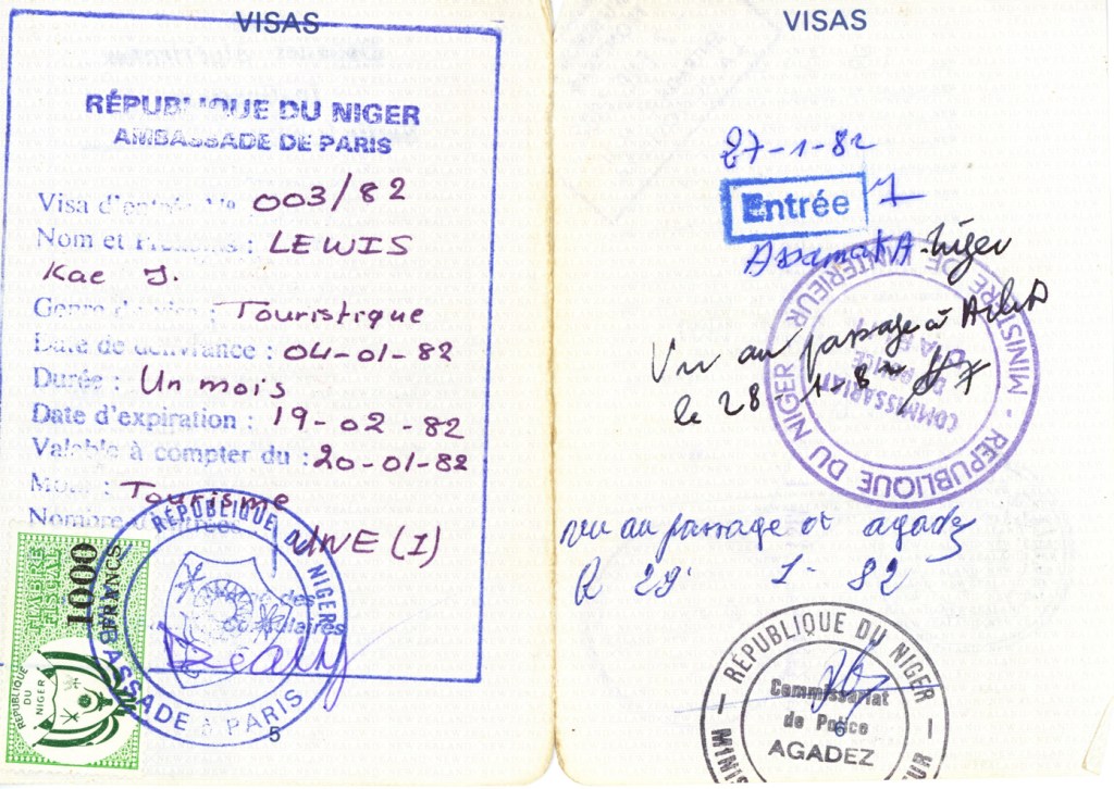
Soon the immigration officers returned with the pile of passports.  The Frenchmen grabbed theirs and disappeared over the horizon in a halo of dust. However, when we spoke to them again in Arlit, they told us that the guards at Assamaka had neglected to stamp one of their passports. The authorities in Arlit required them to travel the 200 km back to Assamaka to obtain the stamp. We dodged that bullet too because, by sheer good luck, our passports had the Assamaka stamp in each one. We did not know enough about the system at the time to check before we left Assamaka but we were learning fast.

A page from my New Zealand passport. On the left is the Niger visa we obtained in Paris and which expired in a few week’s time. If we had taken too long in Algeria, it would have expired before we got there. Without this visa, we would never have been allowed to cross this border at Assamaka. On the right hand side (top) is the all important entry stamp from Assamaka, giving us permission to travel to Arlit. The next day, Arlit gave us permission to travel to Agadez. The authorities at Agadez then stamped us in there the next day. Each time we had to search for the immigration office in town and more importantly, know we needed to visit it before proceeding. There were no instructions handed out, we picked up the knowledge by talking to other tourists. We were tracked like this by authorities throughout Africa and our passports were filling up rapidly. Fortunately, we had requested the New Zealand consulate to attach some spare visa pages into our passports when we were in Paris.

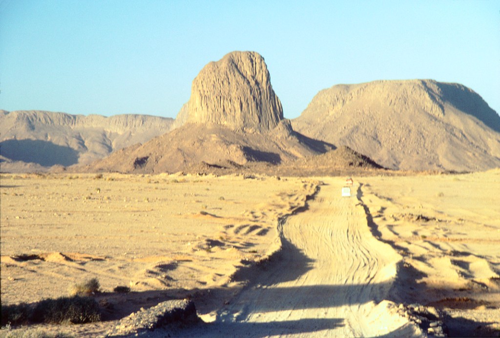
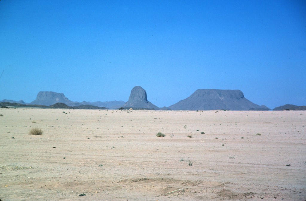
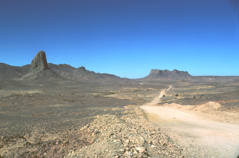
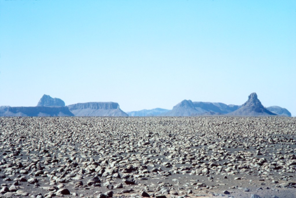
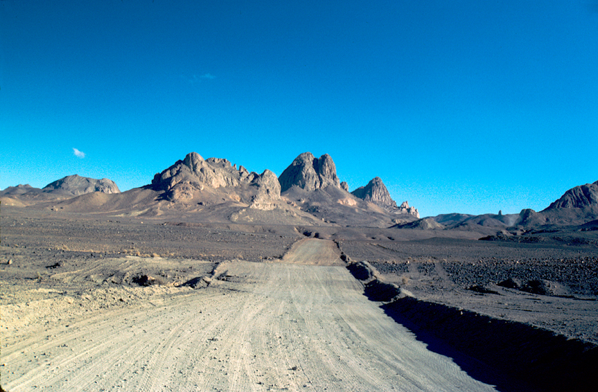
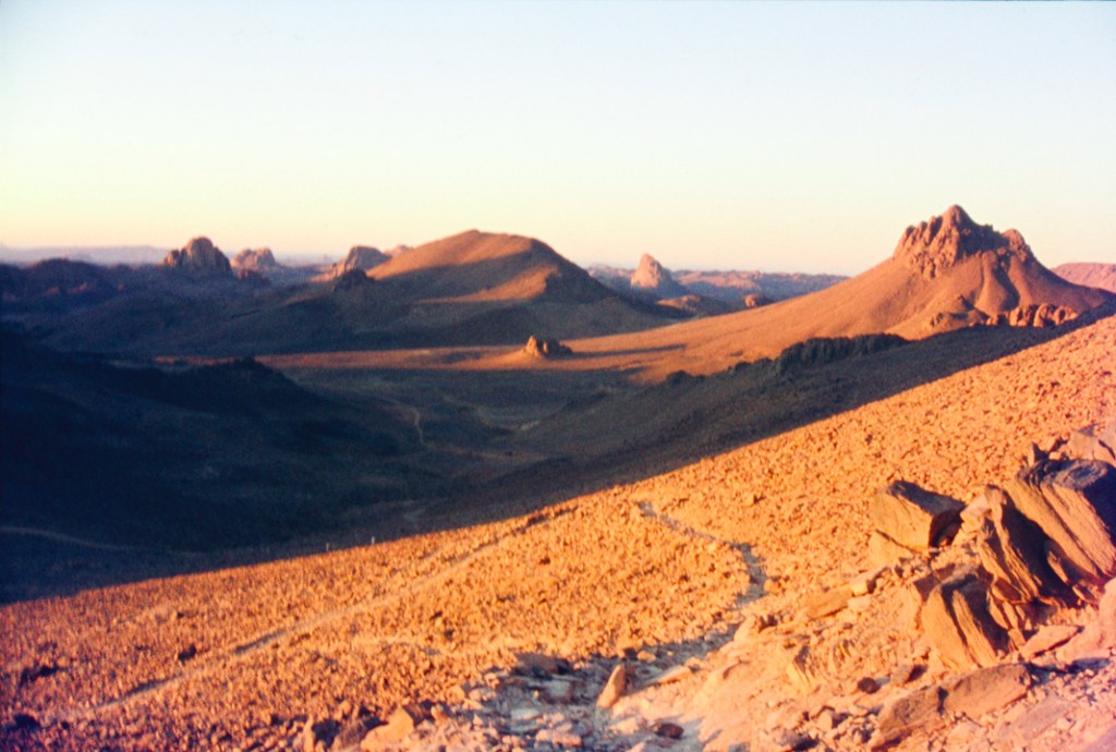
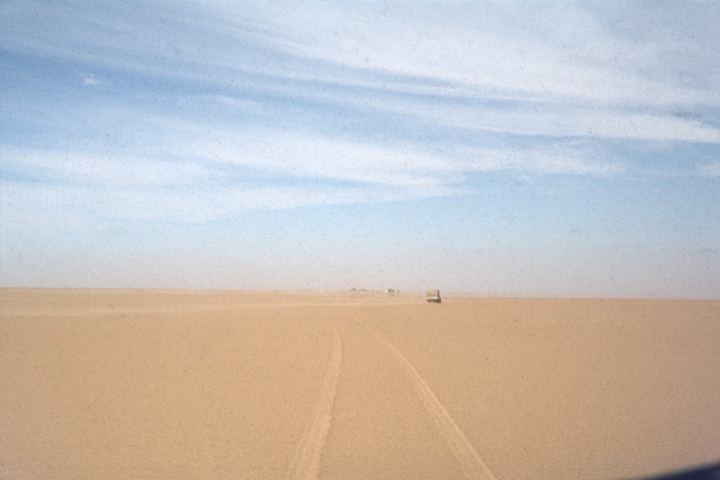
The piste to Arlit was, of course, not signposted. It went at right angles to the route we had traveled on from In Guezzam and was clearly marked with an oil drum placed every kilometer. ‘Clearly marked’ that is to those who realized what the lone rusted drum signified. The wide flat waterless waste of sand and pebbles which surrounded us stretched both southwards, and westwards for a thousand kilometers.  Over the centuries, many travelers have been swallowed up forever by the treacherous desert. This token rusted drum was all there was to prevent you going astray, as we had already done today.

Map of our route from Tamanrasset to Agadez via the border post at In Guezzam in Algeria and Assamaka in Niger. From In Guezzam to Assamaka is only 35 km but we managed to get lost here. The distance from Tamanrasset to Agadez via Arlit is 533 miles (859 km).
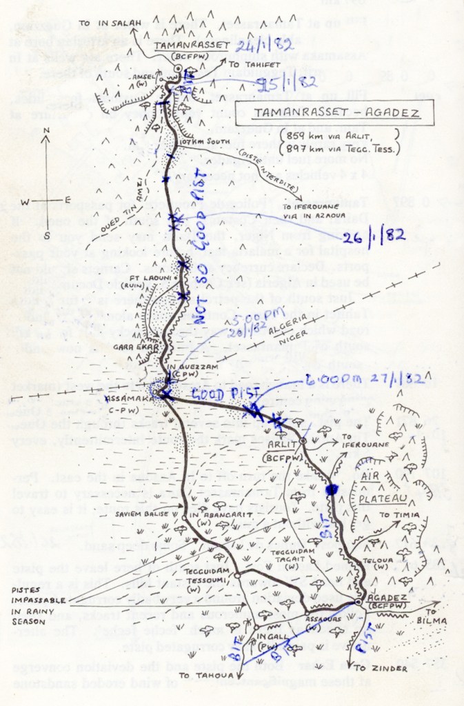
Each cross in blue represents a place where we were stuck in the deep sand, sometimes multiple times for each X.
Bit = Bitumen. Pist = sandy track
Map taken from the book: Sahara Handbook by Simon and Jan Glen 1980

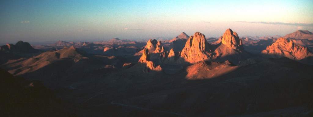
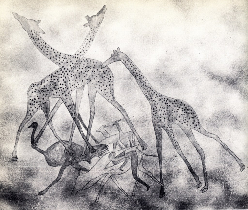
The wind gradually dropped, and after the exertions and sheer terror of the morning’s driving, it was extremely pleasant to relax over lunch, listening to Dr Milburn talking about his work in the Sahara. Because he had just spent a fortnight alone in the desert between Tamanrasset and In Guezzam, he also appreciated our company.   He told us that the entire Sahara had once been populated by stone-age cattle-herders and hunters between 10,000 and 2000 BC.  Evidence of this can be found all around this area in the prehistoric rock-art of which the predominant subject is cattle.  However they also drew horses, giraffes, ostriches, even elephant and rhino, and we tried to imagine a Sahara hospitable enough to support animals like these.  It certainly must have been a wetter and more fertile place than it is today.

By a sheer coincidence, amongst the few books I had with me in the van was Mark’s newly published book: Secrets of South Sahara. Later, I rummaged in the cupboards and brought it out to read the details.
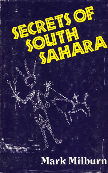
Secrets of the South Sahara by Mark Milburn. Vantage Press 1979.

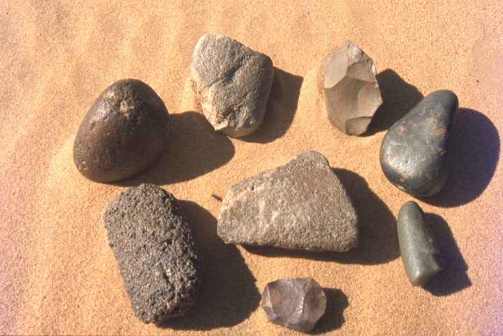
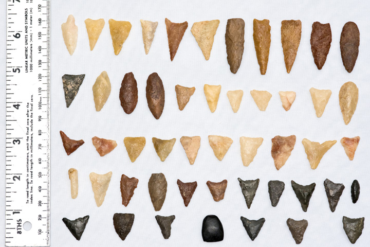
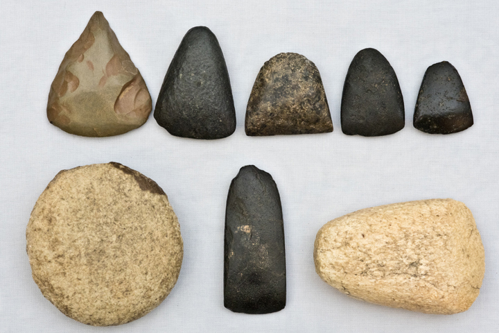
The ancient peoples who lived in this tropical paradise have also left behind their stone tools but, unlike in conventional locations, archeology in the Sahara usually does not involve digging.  Instead, the continuously shifting sands are eternally burying and subsequently exposing the old surfaces when the ancient stone tools and burial sites are to be found merely lying on top of the sand. Mark was particularly excited that day about some large stone gourds he had just found.  They were flat rocks which had been hollowed out to use either as a water receptacle or as a base for grinding meal.  

Mark Milburn on one of his digs in the South Sahara. This photograph was on the back cover of his book, now much rubbed from having travelled in the van with us the entire length of Africa.

Mark was on the lookout for a ‘likely dune’ to check for more tools that afternoon, and he invited us to go with him. Later, as we were driving south-eastward towards Arlit, he waved us to follow him as he left the piste and headed towards a distant clump of trees.  Once we were off the piste, the sand was soft with a hard crusty layer over the top. We dared not stop until we reached harder ground or the wheels would have sunk in immediately.  However the engine was working very hard to push us through the spongy layer of sand, and the temperature of the oil rose to 130°C for the second time that day.  I remembered this crusty layer on top of the sand from my childhood in New Zealand, as it had always formed on the beach following a heavy rainstorm.  As a young child, I loved the feel of the crust breaking with every step I took across the surface in my bare feet.  I knew such crusts formed on the sand after rain, and so it seemed likely to me that it had rained recently in this part of the Sahara too. 

Dr Mark Milburn driving off-piste in search of the remains of ancient communities.

We finally reached the tiny uninhabited oasis which was completely encircled by inhospitable desert.  We were surprised to see that there were spindly grasses growing amongst the scattering of acacia trees.  The vegetation indicated that there was subterranean water beneath the sands, and it may have always been there.  As we looked around us, we tried to imagine a time when this slight depression was a deep crystalline pool shaded by tall pines, with the long reeds dipping in the cool water.  In any case, water will always attract human habitation, and it was on this premise that Mark hoped to find the debris of an ancient dwelling-place.

Long ago, when the Sahara was still green, the not-yet-desert was lively, in all senses of the word. There were forests in the gullies, and on the mountain slopes, massive stands of cypress and pine. The plains were grasslands, as lush as the American praire at the time of the buffalo; reeds, papyrus, and water lilies filled the ponds, and mosses lined the streams. As the desert dried up, and the water supply shrank, growing things retreated to a few specialized habitats. First the cultivated crops like millet disappeared, then the forage, the tough wild grasses. Some grasses, shrubs and trees survived in the wadies, salt-tolerant plants hung on to life on the periphery of the former lakes…The acacia tree has both tap root and a lateral root system to maximize its search for water. The tap root can descend to extraordinary depths.

(From “The Tenacity of Life” in “Sahara” by Marq de Villiers & Sheila Hirtle. Bloomsbury 2002.)

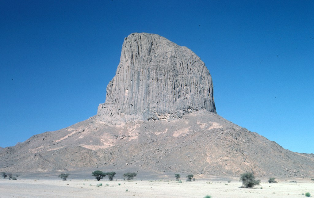
On the Michelin map above, it can be seen that this area, between Assamaka and Artlit, west of the Air mountain system, forms part of an ancient river system that drains this entire region. Today it consists mainly of dry wadies that will fill with water following a rare rainstorm. 4000 – 10,000 years ago however, this region would have formed the drainage area of a huge river system which originally would have linked up with the Niger River far to the south. No wonder Mark had headed straight to this area to look for evidence of ancient human habitations.

Tourists like us were not permitted to go off-piste without permission and so we have to rely on photographs taken by others of the large number of rock paintings that can be found in the Mountain caves of all the Saharan Massifs, including in the Air Ou Azbine Mountains, just east of where we were. These rock paintings show that there were cattle, giraffe, elephants, ostiches, gazelles, antelopes, hippos, crocodiles and fish throughout the Sahara 2000 – 10,000 years ago.
Source: ‘Sahara Story’ by Edward Ward. Norton & Co, NY, 1962

We wandered amongst the acacia trees, peering at the carpet of scattered stones in search of any unnaturally-shaped ones. It was so peaceful and relaxing after the stresses of desert travel that we have faced. This was the first ocassion that we had taken the time to wander around the desert. Without the safety of another vehicle travelling with us to pull us out of the sand if needed, we had been unable to leave the piste and explore before this.

Soon we were finding smooth edged chips from the edges of clay gourds and plates, along with pieces of stone which had obviously been worked but the original shape was no longer recognizable.  I picked up a huge pancake-shaped, smooth round stone which our expert-on-the-spot told us was part of a mortar and pestle set used for grinding cereals. The pestle was lying nearby.

Stone tools, shaped by human hand about 4000 – 10000 years ago, picked up by Kae and Evan Lewis lying on top of the now dry Saharan sand, between Assamaka and Arlit, just west of the Air Massifs, Niger. The well-worn pestle, part of a mortar and pestle set is on the extreme right hand side of the photo (at 3 o’clock). This indicates that humans were once grinding cereals, possibly millet, in what is today a sandy waterless desert.

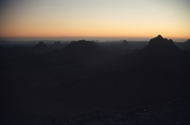
After a happy few hours of wandering around this ancient oasis, we headed back to the distant piste. Soon we hit a large hole which rocked the van unmercifully. The piste became more sandy as we drove on through the afternoon until suddenly there ahead of us was an immense pile of sand which stretched endlessly at right angles to our path. We plunged the van into it but the soft coarse sand quickly overwhelmed us.  Out came the shovels and sand ladders but with each attempt, we jumped only a few meters.  As soon as we came to the end of the sand ladders, the van would instantly sink back into the sand again.  In the end, it required seven attempts before we were finally back on terra firma again. It was not until later that evening that Dr Milburn told us that this abyss is aptly named ‘The Valley of the Dead’.  He had refrained from telling us this whilst we had been firmly caught in its grasp.  

As the sun began to go down, it was difficult to distinguish a hard surface from a soft one.  The hollows in the sand became large bottomless shadows, making it impossible to judge their depth, and adjust our speed to suit. We set up camp on the sandy plateau, and Mark Milburn joined us for a dinner of tomato pasta supplemented with potatoes and onions which were the only fresh vegetables we had left.  There were still some oranges left for dessert, and with a plastic mug of French brandy (undiscovered by the customs officials for all their diligence), we talked on into the night about the stone-age men and women who had walked these plains before us.

That night Dr Milburn slept, as was his habit, under the stars beside his Landrover. Several nights previously, he had woken to find the prints of a large wolf-like animal which had padded around his pillow.  Dr Milburn left us the next morning as he had business appointments in Arlit.  We expected to be stuck in the sand again that day and did not wish to delay him any further.  He spoke of his admiration for our unhurried and calm attitude towards getting unstuck, and he had great confidence that he would see us again in Arlit in a few days.  As we stood and waved him farewell, we could only hope he was right.

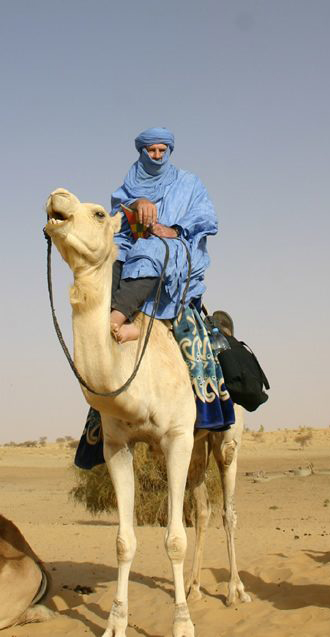
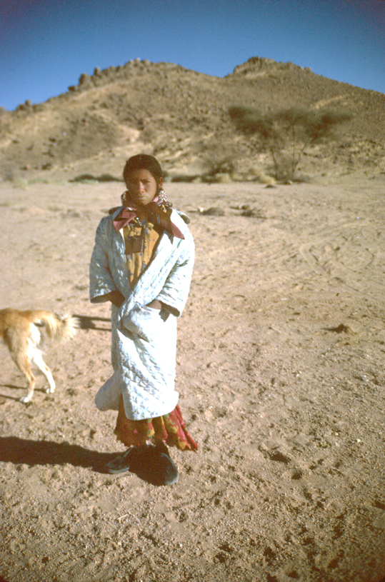
Just as he left, a young Touareg girl with a large herd of camels came wandering over the horizon and, surprisingly, came to visit us just as we were clearing away our breakfast dishes.  She was very hungry, wolfing down two slices of what was now very stale bread that I had liberally spread with strawberry jam. After I had given her the rest of the loaf and shown her how to spread the jam with a knife, she began ladling jam and munching steadily until all the bread was gone. Then she poured the last of the jam directly into her mouth from the pot. She looked longingly at the stainless steel table knife I had given her to spread her jam before carefully handing it back to me.

A young Touareg girl came to share our breakfast of bread and strawberry jam. She was driving a large herd of camels, probably searching for forage in the desert wadies, between Assamaka and Arlit, Niger.

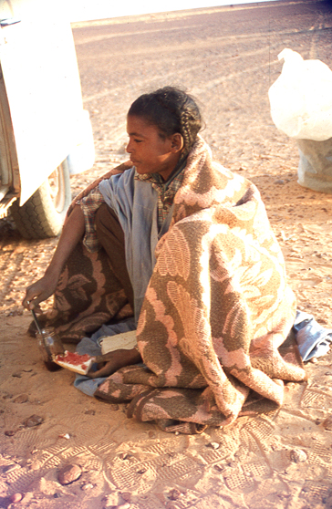
Having breakfasted so well, she was in no hurry to leave. She was now able to concentrate on all the other gadgets that accompanied this amazing vehicle.  She was entranced by a musical calculator we had until we showed her a felt-tip pen. She then set about decorating her arms using bold geometric designs until suddenly Evan’s shiny padlock and chain caught her eye. In all cases, she scrupulously handed each article back after she had experimented with it. We were able to communicate a little in French, and she told us her parents lived several kilometers south of the piste.   Presumably their village must lie in a small unmapped oasis similar to the one we had visited with Mark Milburn the day before.

During all this time, her camels were straying off, and she kept casting them a furtive eye. Eventually she could leave them no longer. We gave her matches, the felt-tip pen and some socks.  We hoped the socks might keep her bare feet warm on these chilly evenings. As we set off,  our dear little desert maiden was near to tears. Even a parting gift of a few sweets did not console her and bring back her lovely smile. It is indeed a lonely life for a teenage girl who, like young animal herders everywhere, should be in school.  With her lively intelligence, dogged inquisitiveness and natural charm, she would do well in the modern world. Instead she is destined to wander the desert, bringing up more children in poverty and ignorance. 

That morning, we were stuck in three sand piles, each of which was nearly as wide as the Valley of the Dead and took seven or eight jumps before we were finally out.  The sand was of much coarser grain than further north, and the van seemed to sink more deeply and be more difficult to extricate.  This was definitely the worst stretch of desert we had encountered so far.

Suddenly the piste led us on to a hard-packed stony plain on which grew increasingly more coarse grass. We were hailed by a Touareg woman who had a baby and three other older children.  They were holding out a small plastic container for water which we stopped to fill for them. Their piteously small animal-skin tent was pitched on the stones nearby.  They were almost certainly victims of the droughts which had afflicted this area in the past.

One of the children raced over to the marker post where they kept their belongings, returning with a bag of stones.  On examining them, we became convinced that they were stone-age arrowheads and cutting tools which Dr Milburn had described to us the previous evening.  When we bartered for them, we soon discovered that her lifelong struggle for existence had made the mother into a hard business woman.  Although they were now in Niger, she asked for Algerian Dinars. The Touareg know no boundaries in the desert and wander without passports from one country to another.  She also asked for food, clothing and matches, and we tried to help her from our rapidly diminishing supplies.  However the stone-age tools we acquired from her were later confirmed as being genuine.

Flint and stone tools and arrowheads collected by the Touareg in the Niger Desert near Arlit and acquired by us with bartering.
Larger stone-age tools collected by the Touareg in the Niger Desert near Arlit and acquired by us with bartering.

Soon afterwards, we were hailed for water again, this time by a young Touareg goatherd who informed us that we were only 10 km from Artlit.  There were stubby trees scattered all over the desert here while his goats were finding plenty of wiry grass to eat.  It began to look as though we had successfully crossed the Sahara  Desert.  The journey had taken us just two weeks of unhurried driving and digging.   

Letter written by Evan Lewis:

Well its 28 January 1982, and we made it across the Sahara, despite getting lost in a sandstorm in the most dangerous part of the desert near the Niger customs post.  With the sand blowing across the tyre tracks that we were following, we missed the ones going at right angles towards the custom’s post.  After driving another 30 miles, we realized – in the midst of a huge sea of blowing sand – that we had surely missed it. Out there, we came across six car-loads of mad Frenchmen in the same predicament, and raced back along our tracks which were rapidly disappearing.  We drove at a dangerous breakneck speed to keep up with them, risking wrecking Katy’s suspension.  

We eventually tracked down the customs post, an old army fort, in the no-man’s – land between Algeria and Niger.  There we met a refreshingly sane Englishman in a Landrover who joined up with us.  He was an ethnologist, Dr Mark Milburn who spoke French and helped us through the formalities with the border guards.  This process involved taking everything out of the van in a sandstorm for the custom’s agents to sort through.  

That night, we camped beside Dr Milburn in the middle of a huge expanse of empty sand between In Guezam and Arlit. The next day, far out in the Sahara Desert, he showed us where to find stone tools. 

Dr Mark Milburn’s Landrover in the wide expanse of very sandy desert near Assamaka, Niger. The bands of rock collect vast sand pits between them, as can be seen in the middle of this photo. We were often stuck in the deep sand seven or eight times before we reached the other side.

In some places, the moisture in the sand varied during the day so that at each hour, its qualities changed.  Feche-feche is very soft sand with a hard crust over the top.  As long as you keep going at least 30 mph, you do not sink through the crust.  However, the rolling resistance is high, and the engine reached 130 degrees C twice (the maximum allowable is 127 degrees C ) but we could not stop without sinking.  This happened once when Mark Milburn took us off the track to go looking for stone-age artifacts in a distant grove of straggly trees.  This ancient oasis formed an island in the middle of a sea of feche-feche.       

Once there, Mark began to pick up pieces of mortars and pestles from the Stone Age.  Kae found a smooth flat disc which had been used for grinding grain against stone mortars.  Mark told us it was only the second one he had seen.  It was a pity we did not meet up with him earlier because he had been visiting cave and rock drawings of hundreds of cattle. Thousands of years ago, the Sahara had been lush pastures for man and his cattle.  The artifacts were coming to the surface near ancient sand dunes which were once fertile and populated lands.  They are exposed by the shifting sands for only a short time before being buried again in the next sand storm.  They lie around in fantastic abundance.  

Mark left us early in the morning of the second day, our pace being a little slow for him as he had an appointment in Artlit. With his 4-wheel drive Landrover, he was not getting stuck at all.  

Soon after that, a young girl appeared out of nowhere with a herd of camels. The camels happily wandered off over the horizon while she passed some time with us.  Kae gave her half a loaf of bread and part of a jar of strawberry jam which she hurriedly gulped down in its entirely.  

The Touareg often stop cars asking for water but sometimes they are obviously camping on the road especially for that purpose.  At one stage, we were in complete isolation in a huge expanse of sand where every vehicle takes a different route when we saw camels silhouetted against the sky over a shimmering mirage lake.  I stopped for photos and in no time at all, the Touareg herder arrived to pose for photos.  He then asked for sugar which is a great luxury to them. Bonbons are also popular, and fortunately we had a good supply.  We were continually being pestered by children in Algeria demanding cadeaux (gifts) – an unfortunate side-effect of tourism.  

The terrain in the Sahara is surprisingly varied. We did not see much of the huge golden sand dunes which were to the east of our route in the Tenére. However we saw quite enough soft sand. We were stuck in soft sand a total of ten times.  When you get stuck, you have to declutch before the vehicle stops moving forwards to avoid digging in. (Perhaps we have not mentioned before that the VW Kombie van has a manual transmission.) Then we did not have to dig so much to get the aluminium planks under the back wheels.  We then laid our old rubber conveyor belts for about five meters in front of the front wheels.  The aluminium sand ladders allow the back wheels to grip and climb out of the hole, and we could then gain some acceleration.  The front wheels produced no friction on the rubber artificial road and when the back wheels came onto it, it allowed us to accelerate up to 10 – 15 mph before hitting the sand again.  In certain types of sand, this speed was sufficient to prevent the van from sinking into the sand again.  I could then drive right out of the bad patch – sometimes hundreds of yards but usually shorter.  Then we had to drag the heavy metal sandladders and canvas conveyor belt all the way back to the van. Fortunately it was never very hot, one of the advantages of crossing the Sahara in the winter.

In the coarser round-particled sand between Assamaka and Arlit, this procedure only allowed the van to leap 30 – 40 meters before it sank back in again.  We then had to repeat this up to eight times to get out of one ‘hole’ in this region.  At that time, we were with Mark Milburn, and he complimented us on our driving technique and for keeping our cool, persevering until we eventually got out.  Apparently many first-time tourists become very depressed and discouraged at this stage and want to turn around and go back.  But we had known roughly what to expect before we started, as a result of reading several books about it.  The reality was not as bad as we had expected in fact. 

The most successful way of getting across the sand without getting stuck is to hit the soft patches at maximum revs in second gear at about 30 mph.  You have to hope that you do not hit any big holes at that speed and flip over, or break the suspension!  Often the only tracks have been deeply rutted by trucks. These ruts are too wide and deep for the VW, and the undercarriage drags on the sand hump in the middle, quickly bringing us to a halt.  That then entails a lot of digging to clear the hump away for a good distance, both underneath and in front of the vehicle.  

While digging in the sand, there was always a danger of snakes, although we never saw any.  We saw some Saharan sand vipers in a zoo in Guardaia.  They move like a sidewinder and lie under the sand without moving until you stand on them.  Then they bite, and you are dead in ten minutes.  They are the biggest worry in the Sahara.   

The Saharan Sand Viper. One bite and you are dead.

While traveling at this speed, you also have to hope that the deep sand is not hiding any big rocks to smash the engine, gearbox or steering gear. You can tell how bad the sand is well in advance by the number of wrecked cars – nearly all Peugeots – around the hole.  Sometimes we saw as many as seven or eight around one sand hole.  Quite a few were burned out VW vans too.   

The Sahara Desert is never boring as it is always changing. You drive across 100 yards of soft sand followed by perhaps 50 yards of flat rock where you pick up speed for the next patch of sand.  There can be some sharp bumps which cause you to hit the brakes.  Our speed was about 30 mph with the engine at maximum revs per sec because the sand was dragging on the tyres.  

Kae played an essential role in navigating through these sand patches.  While I was fully occupied with getting through the immediate obstacles, it was Kae’s job to scan the horizon for the best route around the soft sand which you could distinguish only by the deeper shadows from previous tyre tracks.  Just as you started to speed up, you would hit the brakes again for corrugations.  Sometimes I had time to glance at the scenery but not often. 

We had expected tyre trouble, and other VW owners we had met had experienced three or four blow-outs or punctures.  We have not had a single problem to date, despite carrying five spare tyres.  This is probably because I bought new heavy duty 8-ply oversize truck tyres, steel-belted radials. This decreases torque but that did not seem to be a problem in second gear. 

Often the hard patches have shingle or rock strewn over them or a bit of tussock growing while the soft sand has been dug up by other vehicles.  Sometimes huge flat smooth rocks provide stepping stones or rather launching pads to project you from one patch of sand to the next.  Eventually we learnt that it pays to follow the tyre tracks of the dual-wheeled trucks driven by Arab or Toureg who know the desert well.  They often drive a long way off the beaten track to find hard ground and then return to the piste later. Often Kae successfully navigated us through virgin sand around very bad holes where everyone else had tried to barge straight through the centre.  Most of the other VWs got stuck 6 to 10 times at each sand hole too.  

 I must go as the post office closes soon and I want to post this to let you know that we are alive.  Heading for Kano, then Kenya?  Evan and Kae. 

© Copyright Kae & Evan Lewis 2019. All rights reserved.

Chapter 5: Tamanrasset and the Hoggar Mountains

By Kae Lewis

Tamanrasset lies in the middle of the Hoggar Mountains at a height of 1600 meters (5250 feet) above sea level.  It has been built on either side of a large dry oued  which on rare occasions can become a roaring mass of water coming down off the mountains.  For the rest of the time, the oued  is a large dusty common-area often used by squatters and refugees.  The town is the seat of Amenokal who is the supreme chief of the Kel Rela Touaregs.  He has a residence in Tamanrasset but is more commonly found in an encampment of camel skin tents in the desert nearby.

There are approximately 3000 Touareg living in Tamanrasset.  Originally these tribes were strictly nomadic, dependent on the caravan trade, brigandage and their sheep and camels.  They kept slaves and relied heavily on their labor.  They were truly ‘masters of the desert’, as they always maintained.

A Touareg warrior in traditional robes.

With the coming of the French administration, the Touareg were forced to abandon their raids on oasis villages and farms.  They turned instead to trading desert salt for the millet they needed.  Eventually the Arab merchants began to compete in the desert regions, and the traditional Touareg way-of-life had to change.  When the Algerians from the north took over the administration in 1962, the Touareg were made to release their slaves who then merely squatted on the edges of towns in bewilderment.  Many Touareg began to join in the co-operative farming that was beginning while others fled southwards with their flocks into Niger.

Today many of the drivers of trans-Saharan trucks are Touareg, and this is a modern adaptation of their old style of life.  Trading goods from the North with those of the South forms the basis of their livelihood while they operate the black market with goods obtained along the way.  The old yen for slaves is possibly satisfied by the large number of drifters who attach themselves to the truck.  They sway and bounce high up on the top of the load and are obedient to the commands of the driver in return for their passage.  

An Algerian truck on the outskirts of Tamanrasset. Many of the drivers we saw were Touareg.

Since it was Friday when we arrived in Tamanrasset, the market-place was crowded.  The merchants, who had spread their wares on the ground everywhere, were selling wool rugs and hand-beaten silverware along with household items such as tin pots, clay dishes and long shiny daggers.  We bought some bread, a large sack of oranges and then treated ourselves to some delicious apricot doughnuts being sold hot from the pan.  

Before leaving Tamanrasset, every traveler must obtain permission from the Police de Frontiere at the Diara..  Passports are checked and stamped, and later at the border, they are checked again.  If the required stamp from Tamanrassat is not in the passport, the culprit faces a grueling 500 km trip back to Tamanrasset to obtain it.  Without the ‘Saharan Handbook’, we would not have known this because there is no other way to find out about the various requirements of these meticulous authorities.

The Police also ask each traveler to outline his planned route.  Although the attitude seems to vary from year to year, when we were there, there was no check made on the equipment of those proceeding directly to the frontier at In Guezzam.  Only those wishing to travel eastward to Djanet or westward were required to have four-wheel drive vehicles, to form a convoy of at least three vehicles and to carry a certain minimum of survival equipment.

We were instructed by the Police to drive to the customs office on the outskirts of town.  We finally found this unmarked building only to be told that we were not required for custom’s inspection at all.  By now, we had become so accustomed to this kind of run-around, that we cheerfully accepted this news and drove off.  Because it was now a few weeks since we had been working in the West, the attitude that all time-wasting must be avoided at all costs was slowly wearing off.  We could now see just how tightly wound-up and stressed we had been.  Clock ticking is our great god, and the results are plain to see in the overcrowded coronary-care units of every Western city.

Our experience with officialdom in Tamanrasset was simple in comparison to the experience of Micheal and Nita Marriott when they passed this way in March 1953 in their London Taxi, as described in this extract from Michael’s book “Desert Taxi”:

One week in Tamanrasset, and we are still far from ready to leave. True, Bertha (the 18 year old Austin taxi cab they were driving) is now very different from the poor wreck that limped into the town seven days ago, but now we are wading through red tape which seems more arduous than persuading an ancient London Taxi to cross the Sahara. We are well and truly entangled, and the opposition looks formidable indeed. Three times – or is it four? – I have visited the Commandant of the town and requested permission to continue our journey. Each time he has told me that without a suitable escort vehicle, he absolutely forbids us to leave.

So far, the only vehicles which might possibly have acted as escort have been in an almighty hurry, and the drivers have pointed out that they could not possibly wait for us, with our speed averaging only 20 miles an hour. Most of these trucks, either S.A.T.T. lorries or Arab-owned vehicles carrying merchandise and built specially for desert motoring, travel at double that speed and could not crawl along at our pace – and understandably so. I have approached about seven French and Arab drivers and always the first question is, “What sort of vehicle have you.”

When I tell them, well, we are right back where we started. Nita and I are about the only two people in Tamanrasset who think we are continuing southwards; everyone else is certain we shall be making a return journey to Algiers!

The Commandant is adamant in his refusal, and I can see no way round the regulations. His attitude is understandable: terrible stories are plentiful of lone travellers being lost, or dying of thirst because their vehicles fail them, and I suppose that it is for our own good – but when you have set your heart on anything, logic is rarely acceptable, and, after all, it is our lives which are at stake. There must be a way somehow.

In the afternoon, we hear rumours that a small Génie force (French military) may be going to In Guezzam within the next few days. …(Then) we heard the wonderful news, the rumour of their journey to In Guezzam has been confirmed. They are leaving in two days time, and the Commandant has at last relented and told the Génie officer that he is agreeable to let us go one day in advance of the trucks.

The S.A.T.T depot at Tamanrasset about 1940-1950

Realising that we had got off lightly in comparison to the situation 30 years before, we drove off back to town. We had begun to wonder where we could fill up our water tanks. Back in the main street, we stopped to talk to some German tourists who were driving two VW Kombies.  They told us that they were camping out in the desert where it was possible to obtain water and invited us to join them there.    

The artesian water lying beneath Tamanrasset is not sufficient for the needs of the ever-increasing population as well as tourists and other migrants.  The airport and a grand new hotel brings foreign visitors who expect flushing toilets and twice daily showers.  

The one public tap which we had seen in the market-place had a long queue of more than thirty people, each dragging along several large water containers.  Once the containers were finally full, the householder then staggered off with the water slopping around his ankles.  It did not seem fair that these unfortunate townsfolk should have tourists like us also joining their long queue, and so we were pleased to hear about ‘The Source’ for water in the desert.

The Source was 15 km north of Tamanrasset on the road to Assekrem.  The very sandy road scraped from the desert floor took us past a beautiful steeple-shaped pinnacle, the weathered remains of an old volcano plug.  As we slowly drew near, the sheer grey rock was transformed into a fiery orange by the setting sun.  Just past this peak, we turned off the road and drove towards a mountain range.  The auberge (guesthouse) named ‘The Source’ is a half-finished cottage built at the entrance to a gorge in the foothills.  There is a tap in the yard, and it is possible to induce the proprietor to open the valve.  We paid about US$1 for 50 liters of this naturally effervescent mineral water.

The very sandy road from Tamanrasset to The Source took us past a beautiful steeple-shaped pinnacle, the weathered remains of an old volcano plug. We are following the Germans in their VW ahead.
A closeup of the volcanic plug at The Source.
The hills behind The Source at sunset.

Together with the Germans, we camped a short distance away in the desert.  They were returning from Niger along the same route that we were about to take and were able to pass on much valuable information. We were astounded and very grateful when they gave us their Michelin #153 map of the Sahara since they were now finished with it.  Although out-of-date, it was virtually the only detailed map of the Sahara available at this time.  When we had tried to get it in Europe, it was out-of-print.  We were told that Michelin would not be reissuing it until the long-standing Western Sahara problem has been resolved and the disputed boundaries redrawn. In the meantime, this third-hand copy of the coveted ‘153’ was invaluable to us.  

A very battered, third-hand copy of the rare and much prized Michelin #153 map which we had been trying unsuccessfully to obtain in London and Paris before we left. When it was given to us by fellow travellers heading back home, it became one of our most treasured possessions.

An update for 2019: Michelin have now published a new map of the Sahara, and it is called #741 Africa North and West. It comes with a warning written on the map in red, the same warning that was also on the old #153:

Crossing the Sahara is subject to special regulations. Apply to the appropriate authorities (usually the prefecture or sub-prefecture nearest the Sahara of each of the countries concerned.

As the sun sank, we were camping in the desert near the Source with some German overlanders travelling north in two VW campers. We stayed here for several days for car maintenance and rest.
The volcanic plug we could see from the road could be seen for miles around, this time from our campsite at The Source.

Our German friends set off northwards to Europe early the next morning while we stayed to do some vehicle maintenance and get some much needed rest.  Evan had discovered that the rubber bushes on the rear suspension of the Peugeot, wrecks of which littered the desert everywhere we went, were not much different to the VW model.  He had to reshape the rubber using a pen knife to make it fit in the space available, and then find some other means of attaching a Peugeot bolt to the VW socket. However, the resulting arrangement held together for months under appalling conditions, and a true Kiwi like Evan had once more proved that a ‘number 8 wire’ fix can be invaluable. We were very glad that we would not have to order new VW bushes in Tamanrasset and wait around for them to arrive.

Our campsite near The Source.
A young girl visited our campsite during the day. Most of the children we saw in the desert were dressed in an assortment of cast-off European clothes.

Evan also set the tappets.  This is important for a VW motor which has a tendency to overheat when the air temperatures are high.  Previously, when driving in Greece in mid-summer, we had not had a temperature gauge. Before setting out on that trip, a mechanic had told us that to prevent over-heating in the VW, the motor should be kept at high revs when climbing hills.  The result was cracks in the heads which required an engine replacement on our return.  Now that we had a temperature gauge, we had discovered that in fact the engine must be kept at low revs to minimize the temperature.  Evan decided that we would never allow the oil temperature to rise above 120° C. Whenever it did, we stopped to allow it to cool. Setting the tappets frequently helped to prevent the engine from overheating as well.   

 Our Sahara Handbook recommended that we not miss Assekrem, 85 km north in the Hoggar mountains.  Later that day we set off on a road passing down wide, stony plains between sharp peaks and towering volcanic plugs. There were no signposts, and when the road forked, we chose the road using compass directions only.  

The road to Assekrem wound on down through a series of spectacular weathered volcanic plugs and sheer-faced granite mountains interweaved with vast plains of trachyte rocks.
The road to Assekrem was surrounded in fields of rocks once flung from the surrounding extinct volcanoes.
The spectacular road to Assekrem.
The sheer sides of yet another volcanic plug. The entire area must have been extremely volcanic at one time.
The way that the intense Saharan sunlight played on the sheer rock walls was spectacular.
Rocky outcrops on the road to Assekrem

As we climbed up towards Assekrem, the road became very steep. At one particularly steep incline, we had to tip out some of our water before we finally made it to the top.  However it was not until the last kilometer before Assekrem that we were finally defeated.  It was just too steep for our 1600 cc engine.  Even after unloading some of the heavier objects, we could not make it up to the summit carpark.  Instead we parked at the bottom and prepared to hike to the top.  

 A group of Czechoslovakians in an old Landrover were coming down the hill and stopped to ask us for water.  We gave them some of our diminishing stocks of lovely mineral water to pour into their rusty old radiator which was puffing clouds of steam.  A spare water pump for the radiator would appear to be essential equipment for a Landrover in the Sahara because we met several groups in this predicament. Evan’s temperature gauge had demonstrated quite clearly to us that we could not climb this very steep incline without damaging our engine, and we were glad we had it, even if it did mean we had to hike the last leg to the summit.

The sun was sinking low in the clear blue sky, and we wanted to be at the summit to see the sunset.  We climbed first to the Auberge at the top of the ridge and then on a steep footpath to the stony plateau above.  We paused for a rest at the tiny stone Hermitage originally built by Charles de Foucauld in 1910.  He was a French Benedictine monk who felt that this stark, lonely place was suitably conducive to a life of mediation and prayer.  He also worked amongst the Touareg during times of upheaval. 

Charles de Foucauld of Assekrem

There are two monks (Les petits frere de Foucauld) living there today, and we could hear them at their evening devotions in the chapel as we sat quietly outside.  Their droning voices carried quite clearly through the unmortared stone walls, and I suspect the cold winds whistled in to them through the same gaps at night.  During the day on this stark rocky mountainside, they had no trees to offer shade from the pitiless Saharan sun.

The Hermitage at the summit of Assekrem, built by Charles de Foucauld in 1910 and still occupied by monks when we visited in 1982.

However they are certainly compensated somewhat by having one of the world’s most magnificent views at their doorstep.  All around us were towering needles and conical peaks rising to a maximum height of 2750 meters (9170 feet).  The entire chain became emblazoned in a riot of color from orange to deep purple as the light from the sun slowly extinguished.  The crescendo came when the sun, looking like a huge round piece of glowing coal sank over the horizon, silhouetting the black mountains against a golden sky.  Then the sky turned purple and filled with a solid mat of glittering stars so close that you felt as though you could reach up and pluck them out.  It was easy to see now why a meditative monk had chosen this place to live.  This is the universe in its naked reality where man and his petty ways are reduced to insignificance.

From the summit at Assekrem, Hoggar Mountains. Through the centre of the photo is the road we had attempted to climb up. We can see our van parked on the side of the road at the bottom of the hill.
The entire chain became emblazoned in a riot of color from orange to deep purple as the light from the sun slowly extinguished.  
Assekrem from the summit as the sun set rapidly behind us.
The spectacular scene at our feet is rapidly disappearing as the sun sets.

We had hardly time to catch our breath before the whole scene was plunged into inky darkness before our eyes.  The wind suddenly blew strong and icy cold, biting into any exposed skin and causing numbness within minutes.  We stumbled down the precipitous, rocky path in the dark and were thankful when we finally reached the shelter of the van.  Next time we climb up a mountain to see the sunset, we will try to remember to take a flashlight and warm clothes with us, even if it is broiling hot and bright sunlight when we set out. 

Climbing up the steep rocky path to Assekrem at sunset
The crescendo came when the sun, looking like a huge round piece of glowing coal sank over the horizon, silhouetting the black mountains against a golden sky. 

The following letter was written by Evan Lewis to his parents in New Zealand:

Assekrem, 85 km north of Tamanrasset in the Hoggar Mountains. 24 January 1982.

Assekrem is incredibly spectacular.  Perhaps we will never go to the moon as tourists but this place must be the next best thing.  Even the weather is a bit moon-like.  It was below zero at dawn and windy with fine dust blowing through everything but the minute the sun appeared, it became quite warm.  You can easily imagine that in summer temperatures must approach 40°C.   But in winter it can snow here, despite being right in the middle of the Sahara Desert.  There is virtually no vegetation, although rabbits, donkeys, birds, snakes and scorpions seem to survive somehow.   

The Hoggar mountains must have been a highly active volcanic area a long time ago.  But the dozens of closely packed volcanoes have long since had their outer coating of soil removed by wind erosion, leaving dramatic vertical plugs of lava projecting from plains strewn with volcanic rocks.  These plugs have vertical faces with vertical fissures in the direction of lava flow.  They are sometimes textured with bubble holes like Swiss cheese.  There is even a vulture circling above us to add to the desolate atmosphere.  

Dozens of closely packed volcanoes have long since had their outer coating of soil removed by wind erosion, leaving dramatic vertical plugs of lava projecting from plains strewn with volcanic rocks.

 Yesterday we drove up here from Tamanrasset, 83 km away, to see the dramatic sunset and sunrise.  It took over 4 hours to drive that distance in first and second gears with rock-strewn corrugated sand roads.  We are carrying 100 kg of water and at one stage, we could not quite get to the top of a steep hill.  We unloaded some water canisters near the top, backed down and took another run at it.  We just made it over the top.  Then we had to walk back for the water.  The next time we tried that was about 1 km from the summit of the mountain of Assekrem which we had come to see.  This time, the van reached within six meters of the same point on each of three runs. We decided we would have to strike camp there and walk the 1:3 gradient to the top.  

Once we reached the top of the road, it was another half an hour’s steep climb to the summit overlooking the plain.  The view was spectacular and impossible to describe adequately.  There are hundreds of these volcanic plugs of all shapes and sized sprinkled over the landscape as far as the eye can see.  The colors of the rocks range from deep red through all shades of purple and magenta with a few yellow ones thrown into the mix.  They disappeared in shades of blue and mauve haze in the distance.  The sky was a clear blue and cloudless, and as the sun set, the whole scene began to change color through all shades of orange and red.  

After the sun had disappeared, sinking as an orange orb behind a peak, the sunset was really only just beginning.  The horizon, consisting of these dramatic peaks, was silhouetted against the orange sky.  As time went by, the orange faded into blue and deep purple with stars beginning to appear directly above us.  You feel on top of the world with this huge ring of orange fire completely surrounding you.  There is no longer any evidence of the western point where the sun had set, as the whole circular horizon is orange with an even intensity all the way round.

After the sun had disappeared, sinking as an orange orb behind a peak, the sunset had only just begun.
The horizon, consisting of these dramatic peaks, was silhouetted against the orange sky.

Eventually it became so cold that we thought we might be frost-bitten and made a hasty retreat for the van.  

It is said that the sunrise is even more dramatic,  so despite a body full of aching muscles, I dragged myself out of bed at 6.30 am, before dawn.  Since it was too cold for Kae, I was alone as I began to pick my way once more to the top of the mountain.  This time the view was more spectacular on the way up because the vertical landscape is closer and the plugs, one in particular, tower high into the sky.  Eventually, after a similar display to the sunset in reverse, the sun suddenly appears at the tip of this gigantic spike and sprays the mountains of Assekrem with orange light and you can immediately feel its searing heat, despite air temperatures below zero.  

The sun suddenly appears at the tip of this gigantic spike and sprays the mountains of Assekrem with orange light.

Then back to the world of reality because my hands were suffering badly from the cold. The day before, I had set the tappets, points and timing of the engine before we set out, and in the process, had taken skin off the knuckles of two fingers on one hand and the thumb on the other, all with one slip of the screwdriver while trying to lever the tappet cover off.  Normally that would not cause much trouble but sand blew into them, and they festered badly.  Now they suffered from the cold, and I have both hands bandaged up like a boxer. 

It is said that the sunrise is even more dramatic,  so despite a body full of aching muscles, I dragged myself out of bed at 6.30 am, before dawn.
Assekrem in the cold light of dawn

Kae continues the story:

A map of the Hoggar Mountains, showing the loop road from Tamarasset to Assekrem, near the road to Djanet. We would have liked to go to Djanet at this stage but would have needed to find a convoy before the authorities at Tamanrasset would permit us to go. Besides we still had on our minds that we wanted to go to the Congo if we could, and the rainy season there would be on us if we delayed too much with side-trips. The main road marked in red, coming down from the north through Arak and In Amguel is the road we had just driven from Algiers to Tamanrasset. (Source: Michelin Map #174 Africa North and West.)

Assekrem lies on a loop road to Tamanrasset but because we had not been able to reach the summit with the van, we had to return the next day the way we had come.  About halfway back, a middle-aged European lady came dashing over the stones waving frantically at us. Strangely, she was coming from what appeared to be a native encampment with camels and skin tents.  We stopped as we wondered if she wanted some help. We soon learnt that she was a French journalist working for a glossy travel magazine, and they had hired native guides with camels to take them to out-lying villages for photographic material.  She was endeavoring to produce pictures which did not show plastic bottles and other signs of Western decadence or people with bad teeth or dirty hair.  

“So that the readers can dream,”  she explained to us.

The Parisian suburbanite who flipped through the pages would not wish to see anything nasty. Unfortunately the reality of the situation is that even in the remote areas far from any vehicle track, European influence permeates the entire fabric of life.  Also she had found that the people were almost all in bad health, as we ourselves had already observed, even on the main road.

Her other problem was that the people, being Muslim, did not wish to be photographed.  Their religious teachings forbid depiction of the human body in pictorial form, a situation that every tourist with a camera in an Islamic country is rapidly made aware of.  Since the journalist had a letter of introduction from the Algerian Minister of Information, she was now proposing to return to Tamanrasset to ask the authorities there to send back an official who could force the people to pose for her camera.  She was asking us for a ride into town but when she and her team discovered that we were stopping overnight 15 km before Tamanrasset at ‘The Source’, they changed their minds.  There would be others passing shortly, and as we waved them goodbye, we could only hope that the authorities in Tamanrasset would see reason and refuse to pander to their preposterous demands.

It was for this same reason, that the Algerians on the whole did not like to be photographed, that we have only a few photos of local people in our collection. This was also the reason why we took no photos in the streets and marketplace of Tamanrasset.

Back at ‘The Source’,  we filled right up with their marvellous effervescent mineral water in preparation for leaving Tamanrasset.  Since we were expecting to be driving on sand from now on, Evan changed the four tyres to the sand tyres he had ready. These are wide and had very little tread.  By keeping the air pressure in them very low, they were less likely to dig into the sand and get us stuck. They bulged out on each side, and were now very vulnerable to stone damage.

The next day, we went to Tamanrasset to buy petrol and, as well as filling the van tank, we filled eight jerry cans, making a total of 220 liters.  We spoke later to some tourists who had passed through Tamanrasset a month before us when petrol had been in short supply.  The garages would fill only vehicle tanks and not jerry cans. They had been forced to make several trips out into the desert to siphon petrol from the tank into jerry cans, a dangerous operation.  We were fortunate to be there at a time when petrol was plentiful. Before finally leaving town that day, we bought bread, fruit and vegetables in the Tamanrasset marketplace. There was no fresh meat or eggs available but by now we had grown accustomed to doing without them.

A Tamanrasset street scene looking much as it does today, with Toureg traders with only a few women and large numbers of straying goats.
Source: Sahara Story, by Edward Ward 1962

As we drove out of Tamanrasset, we felt tense and very apprehensive. Ahead of us lay over 500 miles (860 km) of sandy piste before we would reach the next main town, Agadez in Niger. Navigation would be by following the tracks of other vehicles in the sand. We would be crossing the trackless desert where there were few, if any settlements and certainly none that could provide any petrol, water or food, let alone help in emergencies. There would be no medical care or even mechanics and spare parts until we reached Agadez. We were on our own.

© Copyright Kae & Evan Lewis 2019. All rights reserved.